Upper Xingu
The Upper Xingu is one of the research areas related to the Ekologos project, where Prof. Antonio Guerreiro carries out research on the transformation of fishing technologies among the Kalapalo people.[1]
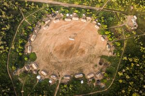
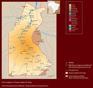
The Upper Xingu is located at the Xingu Indigenous Territory, in Brazil. It is a multiethnic and multilingual complex, inhabited by 11 peoples speaking languages from three of the most important linguistic groups of Lowland South America and an isolate. It is located in a transition zone between the Brazilian Savannah, on the south, and the Amazonian rainforest, which extends to the north.
Our project is being carried out with the Kalapalo, one of the Carib-speaking peoples of the area, who have a population around 1000 persons living in 13 villages, most of them near the Culuene river and its tributaries.
Research questions
Methodologies used
Research publications
- ^ Andrello, Geraldo; Guerreiro, Antonio; Hugh-Jones, Stephen (2015). "Space-time transformations in the upper Xingu and upper Rio Negro". Sociologia & Antropologia. 5: 699–724.

